#LoveMaps
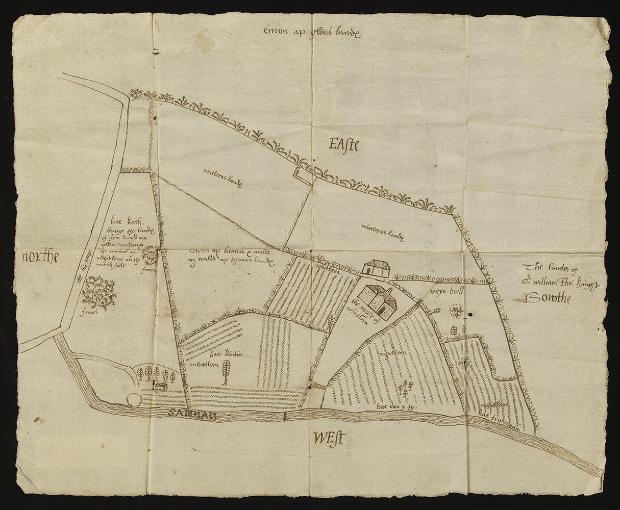
Every Thursday, The National Library of Wales publishes a new blog as part of the #LoveMaps campaign. Individuals are invited to choose their favourite maps from the Library’s collection and this week it was the turn of Dr. Shaun Evans, Director of the Institute for the Study of Welsh Estates, who chose a 17th century map of Whitlera, Carmarthenshire. The map is sketched on a single sheet of paper and shows ‘the mease [i.e. house] of Whitlera’, together with an adjacent building and adjoining lands.
You can read Shaun’s blog here, or click on the links below to find out why the following maps were also chosen as favourites.
Huw Owen, former keeper of pictures and maps at The National Library of Wales
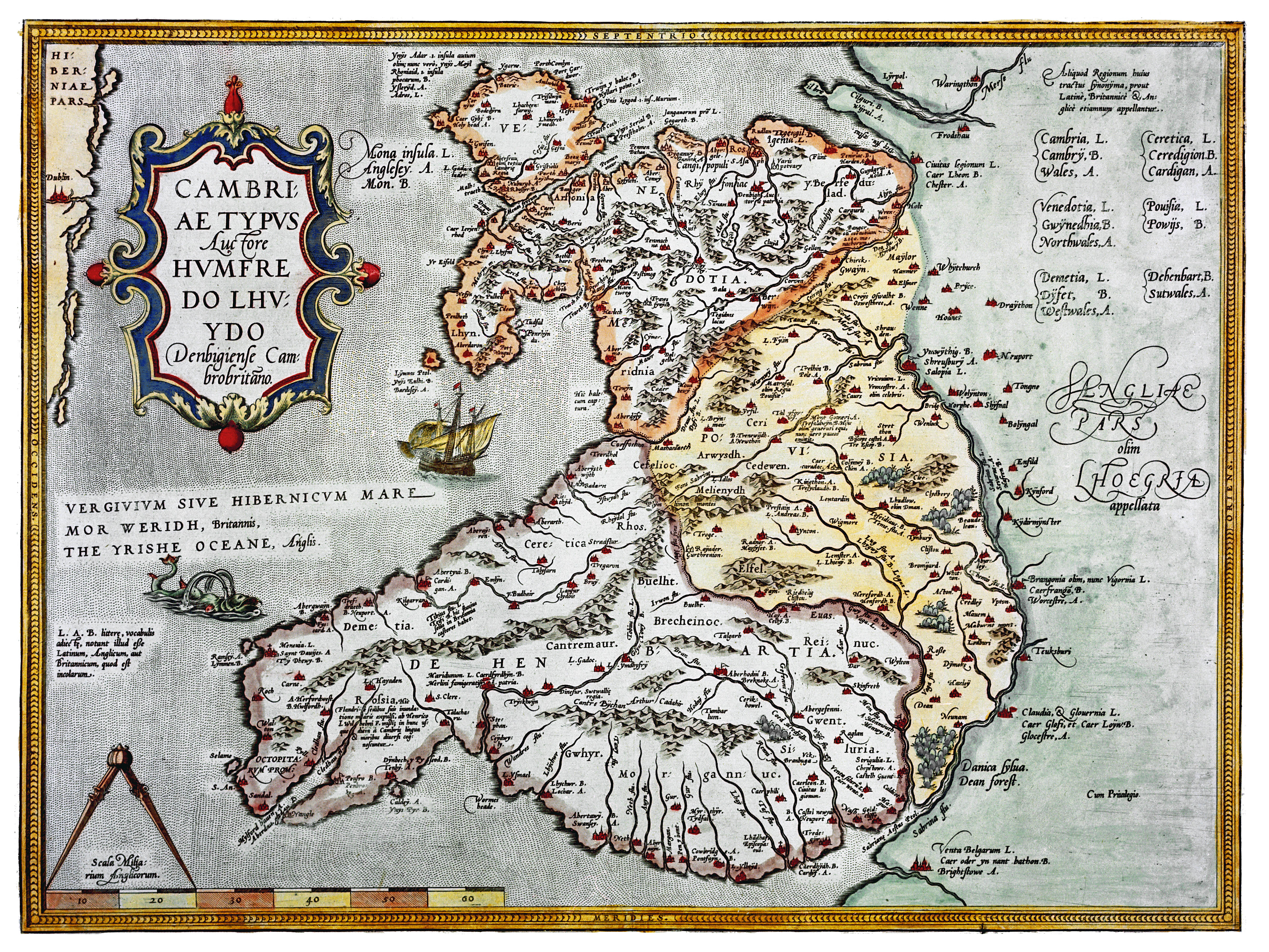
“Cambriae Typus was finely engraved, and measuring 456 x 348mm, the scale of 1 inch to 8.2 miles was displayed in the lower left hand corner. Other decorative features included the title, lettering and illustrations of a ship with three masts in Cardigan Bay and a sea creature near Fishguard.” Read more here
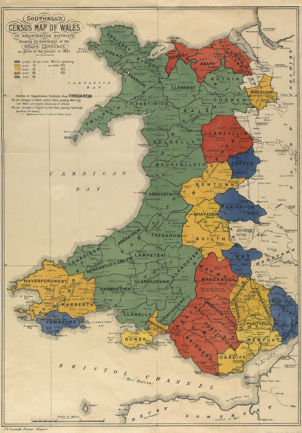
Professor Rhys Jones, Aberystwyth University
“I have always been fascinated by maps that try to depict the geography of the Welsh language. One of the first to attempt to do so was this map by JE Southall, which was based on the results of the census of 1891” Read more here
National Library of Wales Chief Executive and Librarian, Linda Tomos
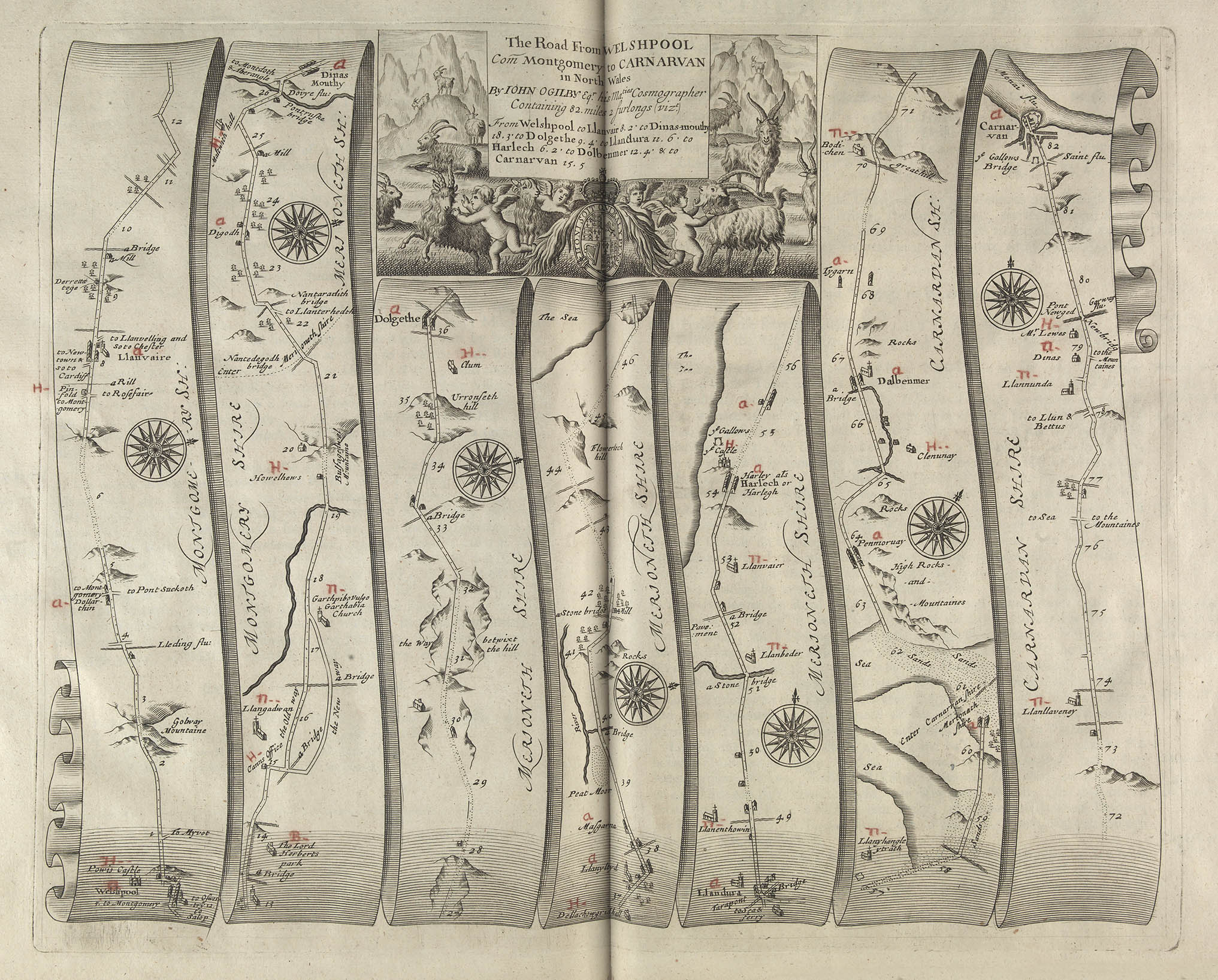
“The maps were arranged in scroll like strip form with each strip containing useful information such as hills and rivers, churches and estates, and whether the road was open or enclosed by hedges. Local landmarks, inns, bridges & fords helped to keep the traveller literally on the right track”
Read more here
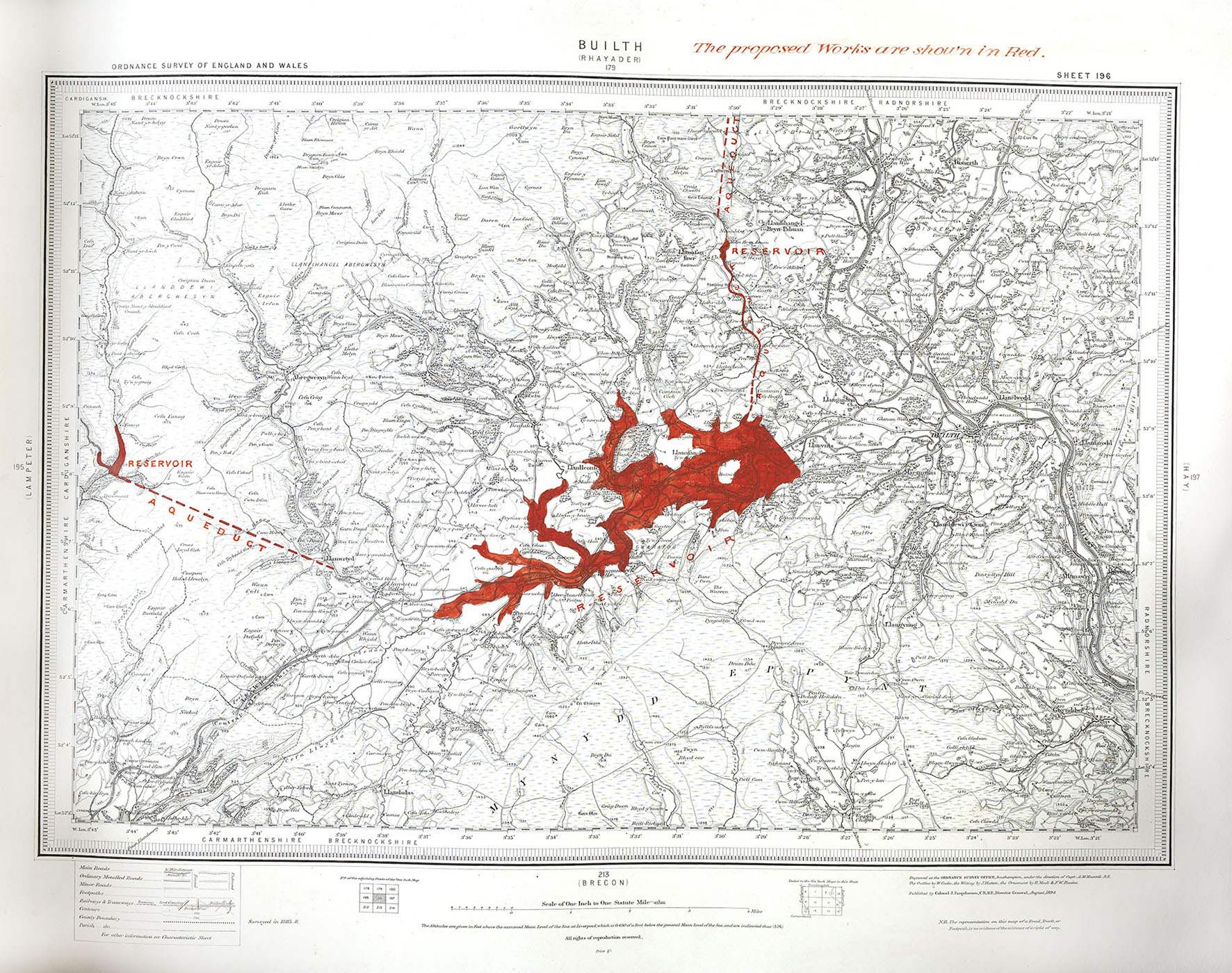
Writer, broadcaster and map addict, Mike Parker
“To water the growing cities, the late Victorian age saw Liverpool building Lake Vyrnwy and Birmingham’s ambitious Elan Valley scheme. London too decided that it wanted a share of Welsh water.
This largely forgotten scheme, intricately detailed in these lovely maps, would have radically altered mid Wales forever.” Read more here
To follow the #LoveMaps blog, click here: #LoveMaps